BGS Topographical Survey Private Limited
Precision Surveying & Mapping Solutions for Infrastructure, Water Resources & Engineering Projects

Topographical Survey | DGPS | GIS Mapping | Canal & Dam Surveys | Geological Studies | Terrain Analysis | Hydropower Survey

Who we are

We Are The Leading Industrial Factory In The World.

Pretium mi risus aptent posuere lacus maximus. Etiam turpis vivamus eleifend libero dolor non maecenas. Posuere vestibulum gravida maximus dictum volutpat integer molestie.

25+
Years of Experience
COMPANY OVERVIEW

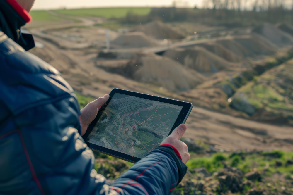
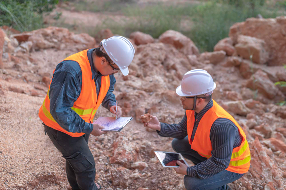
BGS Topographical Survey Private Limited is a Bhopal-based geospatial and survey solutions company dedicated to delivering precision-driven mapping, geological, and infrastructure planning services across India. Since our founding in 2017, we have partnered with public and private sector clients to turn complex terrain data into actionable intelligence empowering projects in mining, railways, water resources, urban development, and beyond.

Years of expertise
0 +
Multi-sector experience
0 +
Resource Planning
0 +
Projects Completed
0 +

CORE SERVICES

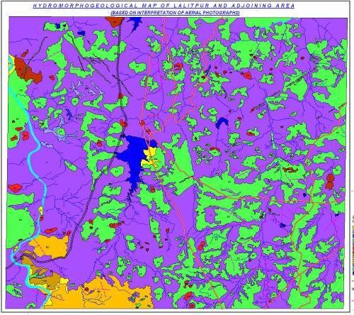
Total Station & DGPS Surveys

Precision Total Station & DGPS surveys for accurate mapping and measurements.

Canal & Dam Surveys

Accurate canal and dam surveys ensuring safe infrastructure planning and monitoring.

Railway & Road Surveys

Reliable railway and road surveys for precise alignment and infrastructure development.

Hydropower Surveys

Comprehensive hydropower surveys for efficient project planning, design, and execution.

GIS Mapping & Cartography

Advanced GIS mapping and cartography solutions for accurate spatial data visualization.

Geological & Hydrogeological Studies

Detailed geological and hydrogeological studies for reliable site analysis and planning.

Reservoir & Watershed Planning

Efficient reservoir and watershed planning solutions for sustainable water resource management.

Terrain & Slope Analysis

Accurate terrain and slope analysis for safer construction and land development.

Remote Sensing & Satellite Data Interpretation

Advanced remote sensing and satellite data interpretation for precise geospatial insights.

3D Base Mapping

High-precision 3D base mapping solutions for detailed planning and visualization.

Infrastructure Planning Surveys

Comprehensive infrastructure planning surveys for accurate design and project development.

Geophysical Investigation

Advanced geophysical investigations for accurate subsurface analysis and site evaluation.

TECHNOLOGY & EQUIPMENT

DGPS Systems

High-accuracy DGPS systems for reliable positioning, mapping, and land surveying solutions.

Total Stations

Advanced total stations for precise distance measurement, mapping, and surveying applications.

GIS Software

Powerful GIS software solutions for efficient mapping, analysis, and spatial data management.

Drone Survey Equipment

Advanced drone survey equipment for fast, accurate, and high-resolution aerial mapping.

AutoCAD Mapping

Professional AutoCAD mapping solutions for precise drafting, design, and survey planning.

Remote Sensing Tools

Advanced remote sensing tools for accurate data collection and geospatial analysis.

WHY CHOOSE US

  • High Accuracy Survey Solutions
  • Advanced DGPS & GIS Technology
  • Experienced Technical Team
  • Government & Infrastructure Expertise
  • Fast Turnaround Time
  • Data-driven Mapping & Planning
  • Customized Survey Solutions
9+
Years of Experience

INDUSTRIES WE SERVE

How it works

When you need experience, we have it covered.

Lorem ipsum dolor sit amet, consectetur adipiscing elit. Ut elit tellus, luctus nec ullamcorper mattis, pulvinar dapibus leo.

Consultation what you need.

Lorem ipsum dolor sit amet, consectetur adipiscing elit. Ut elit tellus, luctus nec ullamcorper mattis, pulvinar dapibus leo.

Create a contract for work.

Lorem ipsum dolor sit amet, consectetur adipiscing elit. Ut elit tellus, luctus nec ullamcorper mattis, pulvinar dapibus leo.

Production the item

Lorem ipsum dolor sit amet, consectetur adipiscing elit. Ut elit tellus, luctus nec ullamcorper mattis, pulvinar dapibus leo.

Quality control before delivery

Lorem ipsum dolor sit amet, consectetur adipiscing elit. Ut elit tellus, luctus nec ullamcorper mattis, pulvinar dapibus leo.

CLIENT TESTIMONIALS

Need Accurate Survey & Mapping Solutions for Your Project?"